
Smoke West of Hamilton Was Planned by Forest Service
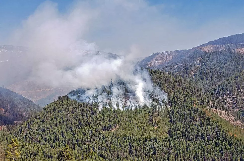
Quite a few people called Ravalli County 9-1-1 Monday, October 19, reporting a huge amount of smoke at the mouth of Canyon Creek, just south of Blodgett Canyon. The smoke, though, was not an emergency. It was one of the first "pile burns" of the Bitterroot National Forest's annual fall prescribed burning projects that burn up slash wood piles from thinning work and woodcutting.
Officials put out a notice on the "Discover Bitterroot National Forest" Facebook page Monday, along with a video of some of the operation. "Firefighters are on-site and will continue to manage and monitor these piles throughout the day and evening. Pile burning is conducted to reduce fuels and slash left over from previous operations."
Burning was also being conducted up the West Fork, at the south end of the valley Monday. The entire burning plan that started this week includes:
Stevensville Ranger District: Burn Piles covering about 30 acres will be lit in Three Saddle units east of Stevensville on Ambrose Road 428, and 9 acres of hand-piled wood from clearing and hazard repair at the Larry Creek Group site, the Gold Creek Campground and the Fred Burr trailhead on the western side of the valley.
Darby/Sula Ranger District: Burn Piles covering about 900 acres are planned - Canyon Creek west of Hamilton, Waugh Fuels Reduction south of Sula near Waugh Creek, East and West Tolan up the East Fork south of Sula, Westside 18 west of Charlos Heights and Cameron Blue 8 miles east of Sula on the north side of the East Fork.
West Fork Ranger District: Burn Piles of about 900 acres - Lower West Fork Unit 1 south of Pierce Creek, Frazier 65A north of Baker Creek, Lone Pine southwest of Ward Creek, School Point Bravo/Charlie between Wheeler and Nelson Creeks, Nez Perce Ranch along Nelson Creek, Two Creek east of Two Creek along forest roads 732 and 732A, Tough and Mud Saddle along forest road 5644, Painted Rocks West Units 1-4 south of Coal Creek and Overwhich Units 1-4 along Overwhich Creek.
The fires are done in coordination with county and state health officials, with special attention to air quality. The public should be aware of fire crews and vehicles and try to avoid those prescribed burn areas. More information is always available at the Bitterroot National Forest Facebook page or at their official website.
8 Movies That Filmed in Montana
More From 96.9 Zoo FM